
01
Observe
Hydrological, meteorological and territorial evidence.

A safety-first decision-intelligence platform helping municipal teams organize flood evidence, anticipate short-horizon river behavior and understand territorial exposure — with uncertainty visible and humans in control.
Evidence first. Uncertainty visible. Humans in control.
Current pilot · Lajeado + Estrela · v0.50.1-aws
Climate-risk decisions can depend on fragmented evidence held across different sources, formats, times and institutions. GeoAlerta is being developed to organize that evidence without hiding its limits.
Hydrology
SRC / HYD
Weather
SRC / MET
Terrain
SRC / DEM
Risk sectors
SRC / SGB
Population
SRC / POP
Critical infrastructure
SRC / CIF
Historical events
SRC / HST
GeoAlerta
Unified evidence layer
Human reviewA traceable flow from observations to human-reviewed planning context — designed to make knowns, unknowns and source quality legible.
Hydrological, meteorological and territorial evidence.
Experimental short-horizon river-level intelligence.
Population, critical facilities, terrain and official risk areas.
Traceable evidence, uncertainty and human verification.
GeoAlerta started in a region deeply affected by extreme floods. This demanding real-world context is the proving ground for developing and rigorously validating the methodology before any geographic expansion.
Current proving ground
Lajeado + Estrela
Region
Vale do Taquari
State
Rio Grande do Sul
Country
Brazil
Retrospective validation and prospective research remain essential. This pilot does not establish universal validation.
Evidence time
Recent
Forecast window
1–6h
Review
Human
River level
Evidence
Recent observations
Forecast horizon
1–6h
Experimental estimate
Uncertainty
90%
Interval remains visible
Data freshness
Gated
Stale / future / inconsistent
Official risk sectors
SGB
Planning context
Population exposure
Layered
Territorial analysis
Critical facilities
Mapped
Exposure context
Digital Twin
Planning
Human review oriented
Real screens · live experimental environment
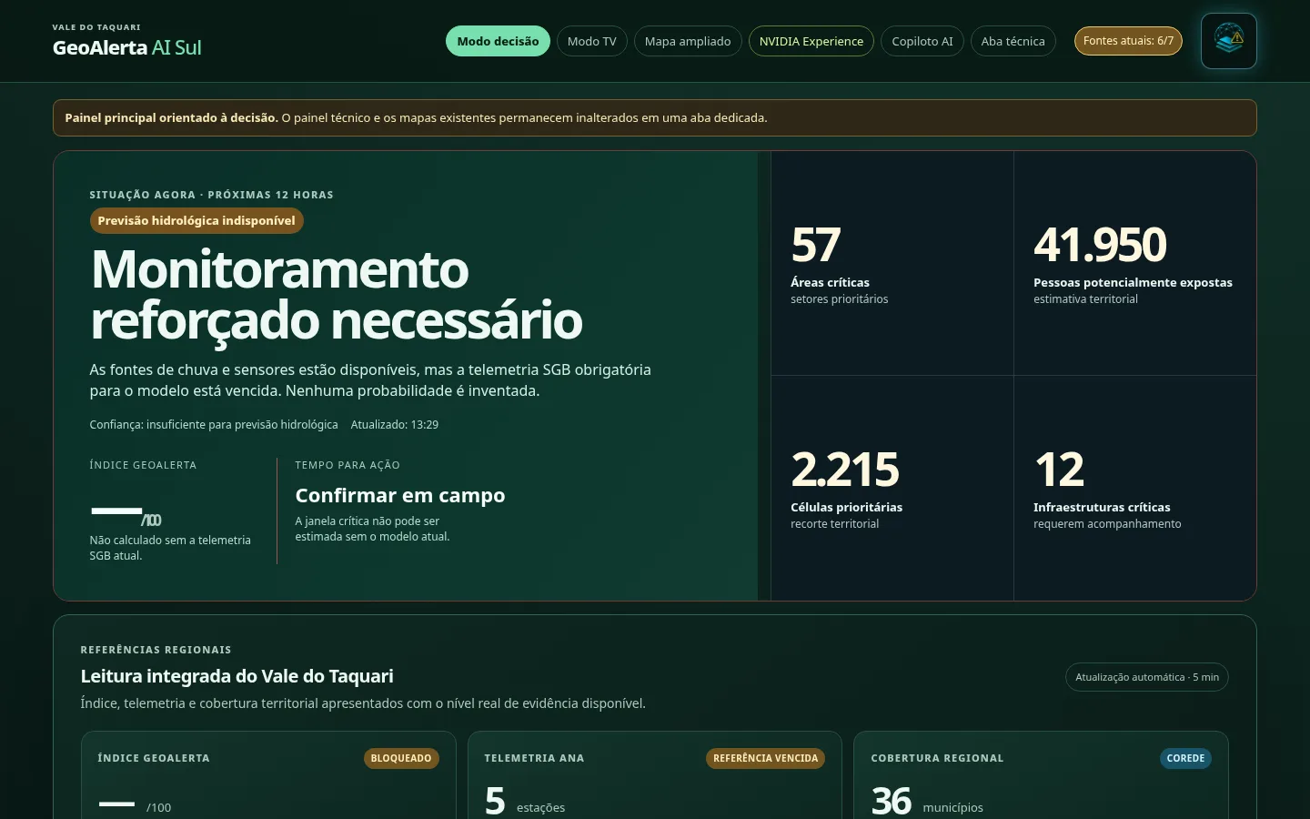
Decision panel
Situation summary with evidence status — no probability is invented when data is stale.
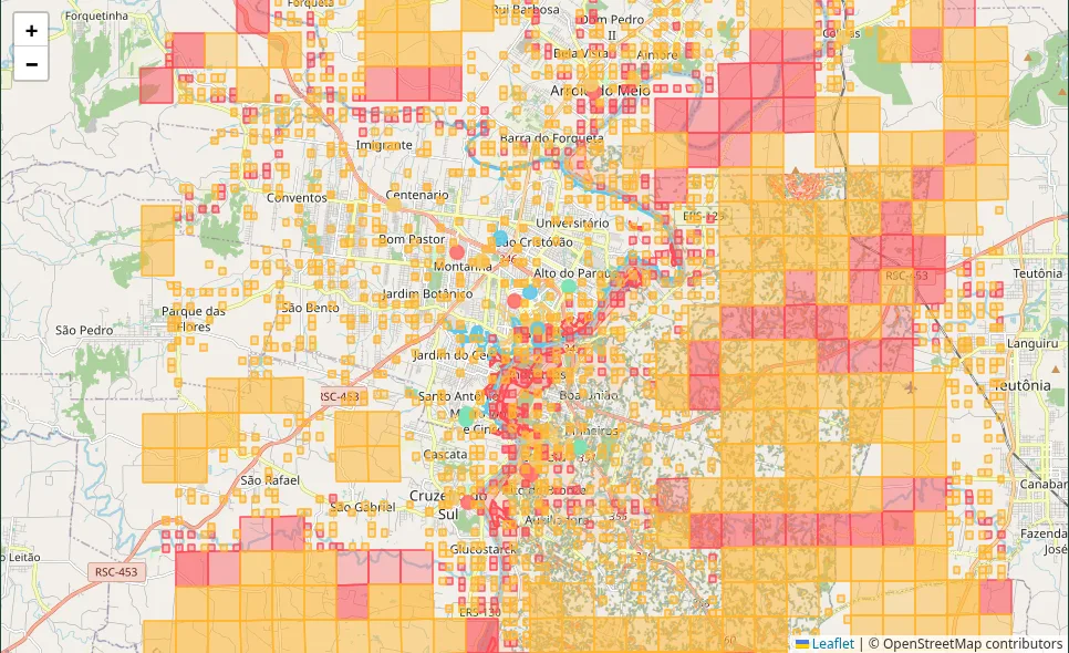
Territorial exposure map
SGB risk sectors, exposure cells and critical facilities for planning context.
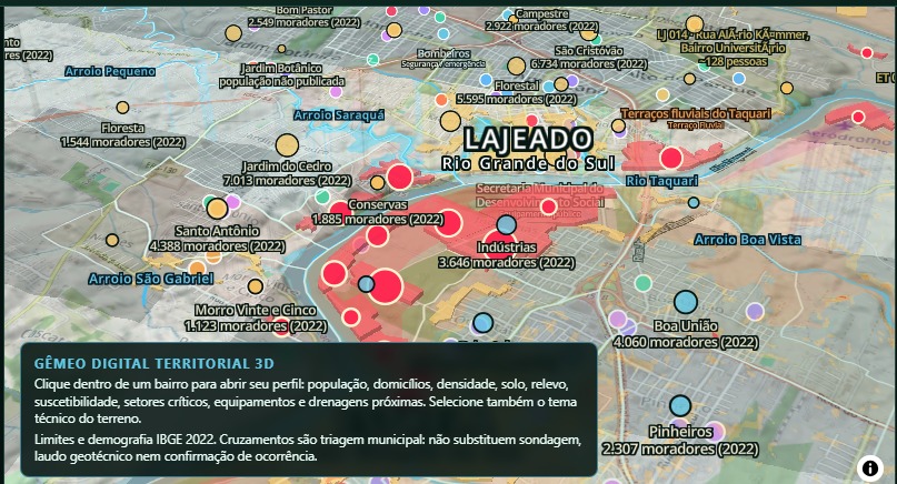
Planning digital twin
Operator-defined hypothetical scenarios — not a forecast and never an evacuation order.
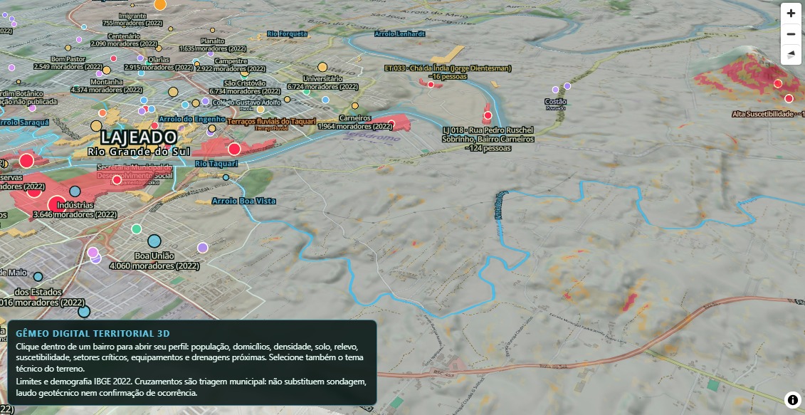
Territorial Digital Twin 3D · Lajeado
Neighbourhood profiles on 3D terrain: population, susceptibility, critical sectors and facilities (IBGE 2022). Municipal triage — not a geotechnical report or confirmation of occurrence.
Screenshots of the experimental environment (Vale do Taquari). Figures shown are planning estimates, not official alerts.
The interface is being developed around explicit limits, traceable inputs and human judgment — not false certainty.
Operational notice
GeoAlerta AI Sul is not an official public alerting system. Public warnings, evacuation and interdiction decisions remain with Civil Defense and competent authorities.
Early 2026
Foundation
Hydrology
Territory
Assurance
Integration
Vale do Taquari 2026
Each stage represents added capability. The early concept did not contain the scope of the current integrated experimental environment.
Technologies evaluated or integrated in the experimental environment.
Technology references describe engineering context only and do not imply commercial partnership, endorsement or certification.
Aggilli Intelligence is a Brazilian early-stage AI and data science startup seeking partners to move GeoAlerta from a technically substantial experimental pilot toward prospectively validated and repeatable municipal deployments.
Test the methodology with public teams in real planning contexts.
Support focused product and validation milestones.
Advance public-interest research and resilience capability.
Help scale geospatial and AI experimentation responsibly.
Strengthen evidence coverage, quality and provenance.
Design rigorous evaluations with research institutions.
Describe your territory and flood-resilience priorities. An AI assistant drafts a preliminary scoping brief and discussion questions to bring to our first conversation.
An AI-generated starting point for discussion, reviewed by the Aggilli team before any commitment. It is not an assessment, validation or offer. GeoAlerta AI Sul is not an official public alerting system. Public warnings, evacuation and interdiction decisions remain with Civil Defense and competent authorities.
We are attending Smart City Expo World Congress Barcelona 2026 to meet cities, investors, accelerators, climate-resilience organizations and technology partners.